
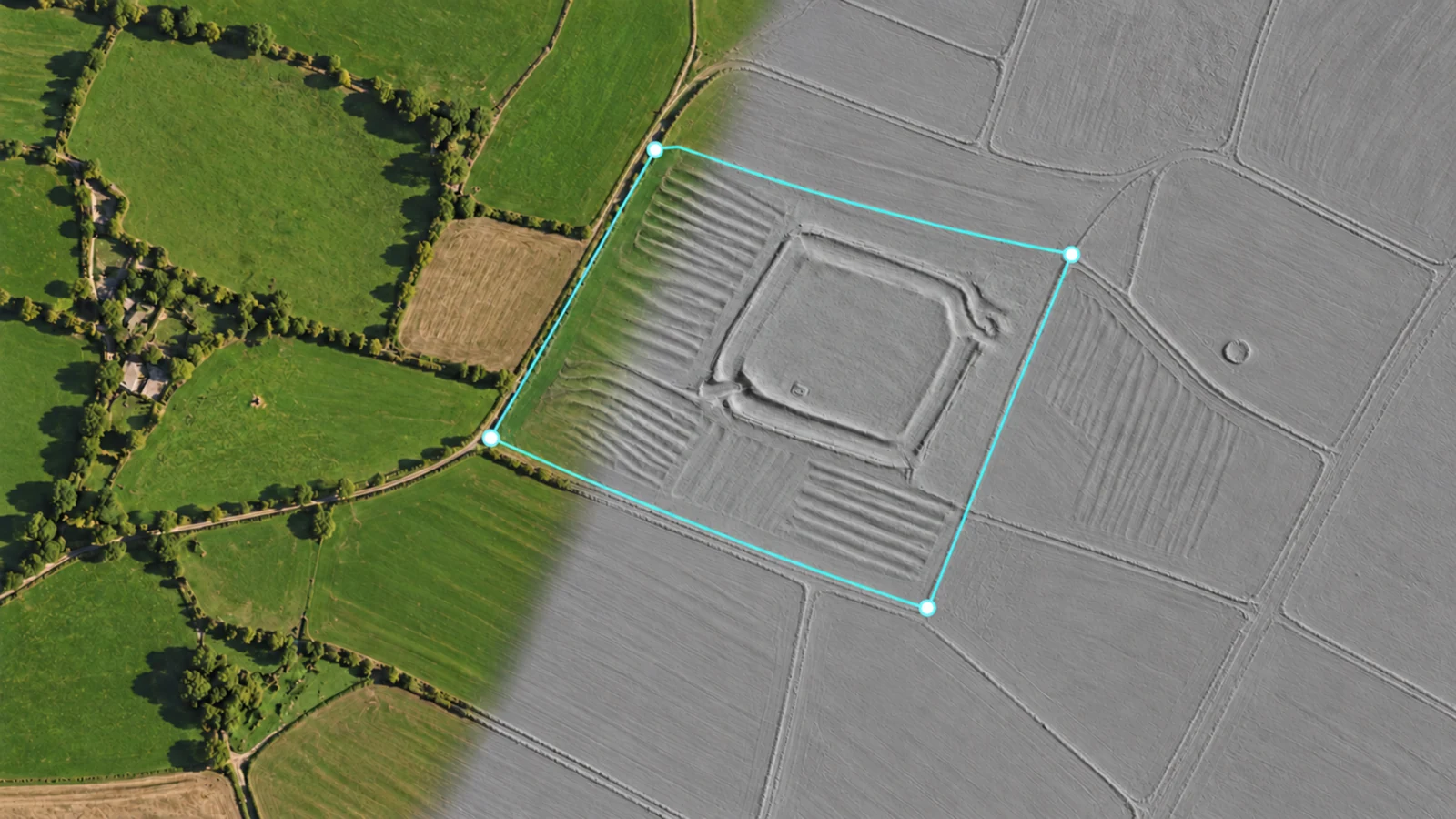
1.1.0 / REVEAL MORE WITH LIDAR
Read the landscape in a new way.
Explore subtle earthworks, historic boundaries and terrain changes through a LiDAR layer in DetectBuddy. The new perspective sits alongside your map, so it can become part of how you prepare and record your detecting days.
A redesigned Planning interface
A refreshed layout brings search, date, preparation and settings together, with clear Area, Pin and Route drawing tools. Meet the new Planning.
Notes for your plan
Keep access details, meeting arrangements and reminders with the whole plan. Plan preparation notes sit alongside your separate map-pinned notes.
Checklists for a prepared day
Build a preparation checklist, tick off equipment and save a useful list as a reusable template. Each plan keeps its own preparation progress.
LiDAR in Planning and Recording
Explore terrain imagery while planning your next outing or recording your route. Turn the layer on and off from its map control.
A view you can blend
Swipe vertically on the LiDAR control to adjust opacity. Bring out terrain detail or reveal more of the underlying map.
The right source for the area
Automatic mode selects the source for your map location. You can also select an available source manually in map settings.
A chance to explore
Eligible users have one five-minute LiDAR preview. Continued access is included with DetectBuddy Pro.
Where can I use it?
LiDAR terrain is available in England and supported areas of the United States. Coverage varies by location. Access is supported for UK and US App Store storefronts; the app shows availability for the area you are viewing.
How does LiDAR affect my privacy?
Your finds and recorded routes remain on your device. LiDAR imagery is requested directly from the Environment Agency or USGS for the map area you are viewing. These requests can reveal the viewed area and ordinary connection information to the provider. Your saved finds and routes are not uploaded to them. Read the full Privacy Policy.